While astronomy is a great interest of mine, I’ve long been a student of history, especially the history of my hometown, Cleveland, Ohio, and generally Ohio history. I recently finished reading Heckewelder’s Narrative, an important primary source of Ohio history. This, combined with my love of cycling, gave me the motivation to celebrate my recent 60th birthday by embarking on a solo bicycle adventure. (Lots of words right below, followed by lots of pictures.)
BACKGROUND AND REASON FOR THE BIKE TRIP
The first European settlers in Ohio were Moravian Missionaries who worked among the native tribes in this region. David Zeisberger was the head of this mission in Ohio, starting in 1740. John Heckewelder was his younger associate. The Moravians did wonderful work among the native tribes, and enjoyed much favor among the chiefs of the Lenape (Delaware) tribe. In addition to sharing the Gospel of Jesus Christ, the Moravians educated their native converts, teaching them agriculture, reading and writing, and other methods that led to their prosperity. The “praying Indians” were envied by their neighbors who did not convert and did not reap the benefits of farming life. Unfortunately, American history took a bad turn. Much of the so-called French and Indian War was fought in Ohio, and the Moravians were caught in the middle. Things only got worse during the American Revolution.
To make a very long, very sad story very short, the Moravians suffered greatly, being distrusted by both the native tribes and the American settlers. They were forced to move repeatedly, and in 1782, 93 of the praying Indians were slaughtered by the U.S. Army at the Gnadenhutten Massacre. That tragedy and the events leading up to it are dramatized in the wonderful outdoor drama, Trumpet in the Land, a great summer activity in northeast Ohio. Afterwards, Heckewelder and the surviving praying Indians briefly settled along the Cuyahoga River, which represented the first European settlement in what is today the Cleveland, Ohio area. In fact, Heckewelder drew a map for Moses Cleaveland, the founder of the city, who led the first survey party to the mouth of the Cuyahoga in 1796.
Having just finished reading Hecekwelder’s Narrative, I learned that David Zeisberger was buried in Goshen, Ohio, not far from the settlements of the praying Indians at Schoenbrunn and Gnadenhutten which he helped establish. The former town is near modern day New Philadelphia, Ohio, which also happens to be the terminus of the Ohio & Erie Towpath Trail. The Ohio & Erie Canal was created In the generations following the first Moravian settlement. This canal followed the Cuyahoga River from Lake Erie and bridged over the Tuscarawas River into southern Ohio, and on to Columbus and the Scioto River, down to Portsmouth along the Ohio River. Starting in the 1820s and 30s, the O&E Canal, along with the Erie Canal through New York State, provided a water route across the American continent that connected New York City to New Orleans, which helped establish the early American economy. The O&E Canal was eventually replaced by the railroads and, in recent years, the former towpath of the canal has been repurposed into a modern hike and bike trail with many historical sites along the way.
So anyway, upon learning that the grave of David Zeisberger is just outside of New Philly, the southern terminus of the Towpath Trail, I decided to ride my bike to the site, and make a bicycle pilgrimage to pay my respects to the great missionary who was, in so many ways, the Father of Ohio.
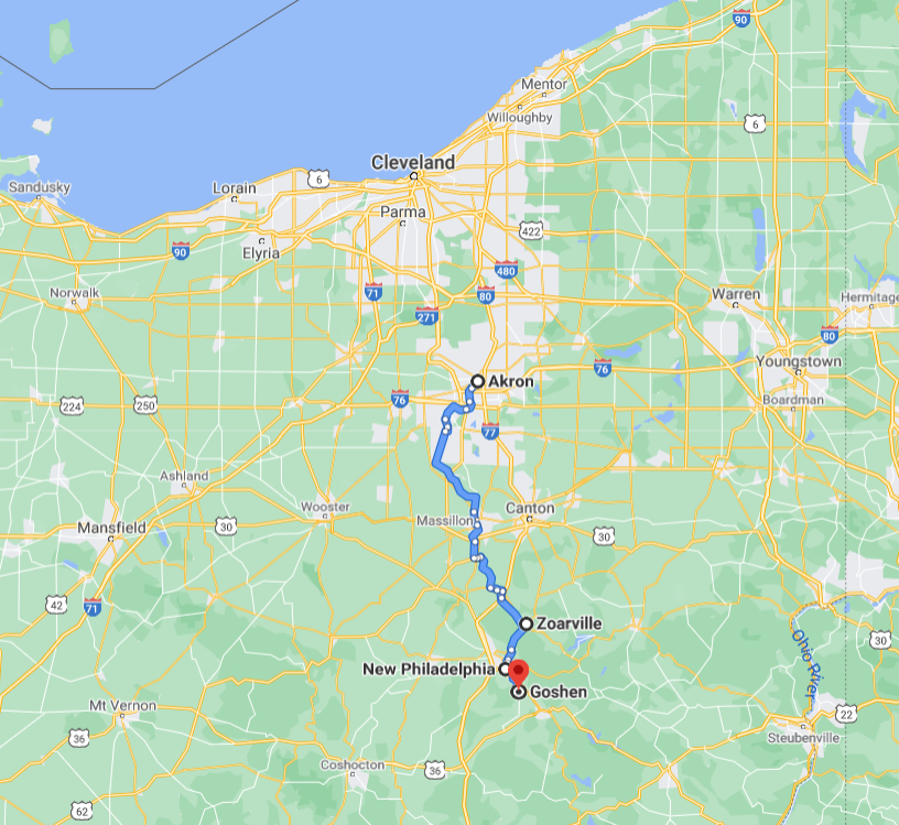
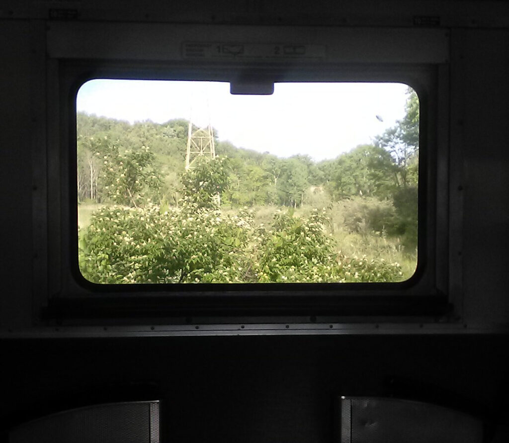
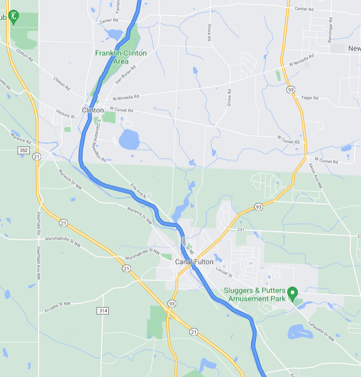
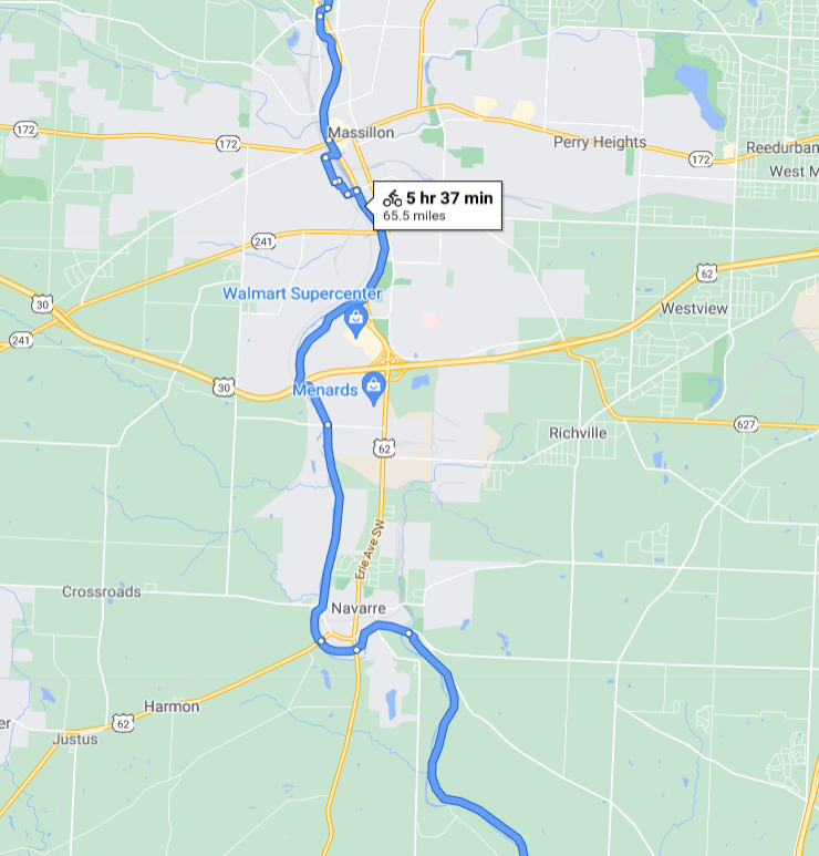
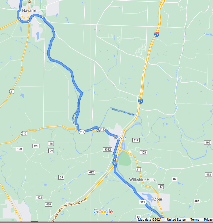
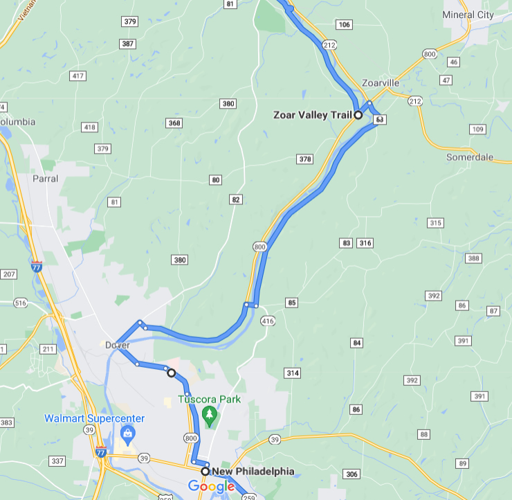
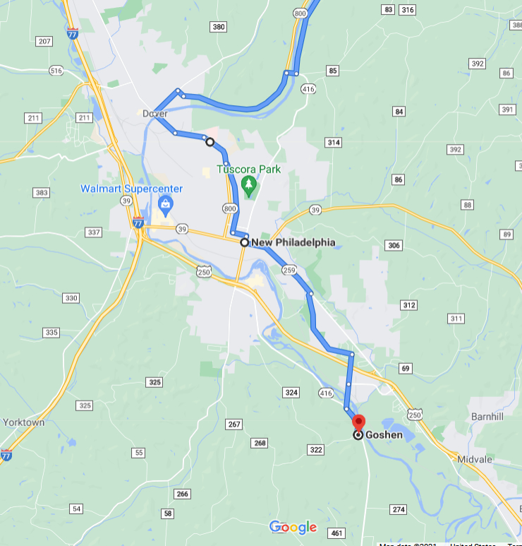
The above map shows the bike route I followed. I rode my bike from my house in Cleveland to the Rockside Road station of the Cuyahoga Valley Scenic Railroad where, for a mere five dollars, I enjoyed a pleasant train ride with my bike to Akron, Ohio. (What else can you get for five bucks these days? What a bargain!) This shaved 35 miles off the ride, and made it feasible to complete the ride in a single day. Here’s the view from the train.
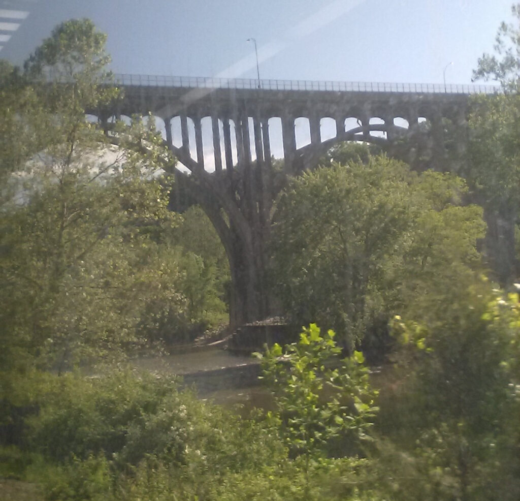
It was a very pleasant morning on Sunday, May 30, 2021. Here’s the scene along the Cuyahoga River of the Rt 82 bridge in Brecksville.
THE BIKE ADVENTURE BEGINS! 10:30 AM
I got off the train in Akron and rode south along the Towpath Trail.
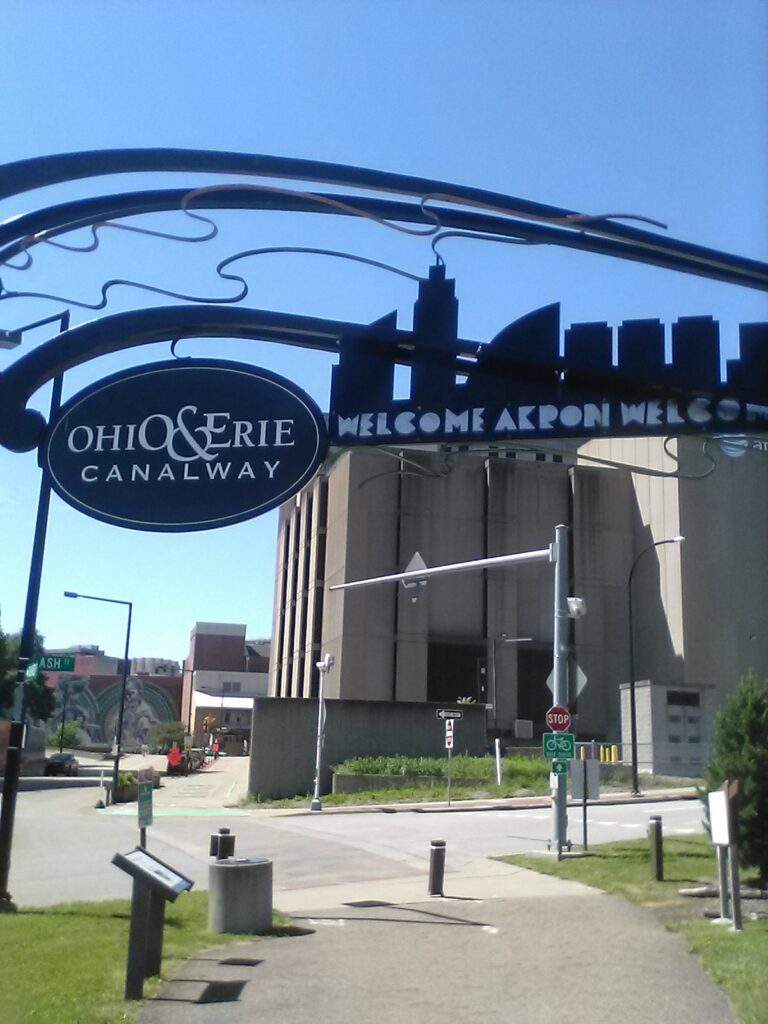
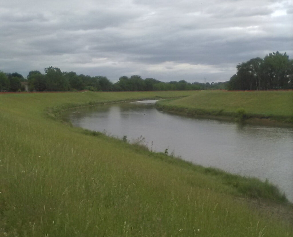
It started out as a beautiful day for a big ride, but became cloudy as I rode south. The scene below is Summit Lake, a beautiful natural lake to the south of Downtown Akron. The City of Akron, Ohio was the highest point along the O&E Canal. The word “akron” is the neuter form of the Greek word “akros” (ἄκρος) which means “peak” or “summit,” as in the top of a mountain. You might have heard of the Acropolis in Athens or “acrophobia,” a fear of heights. And for this reason, the City of Akron is the county seat of Summit County, Ohio.
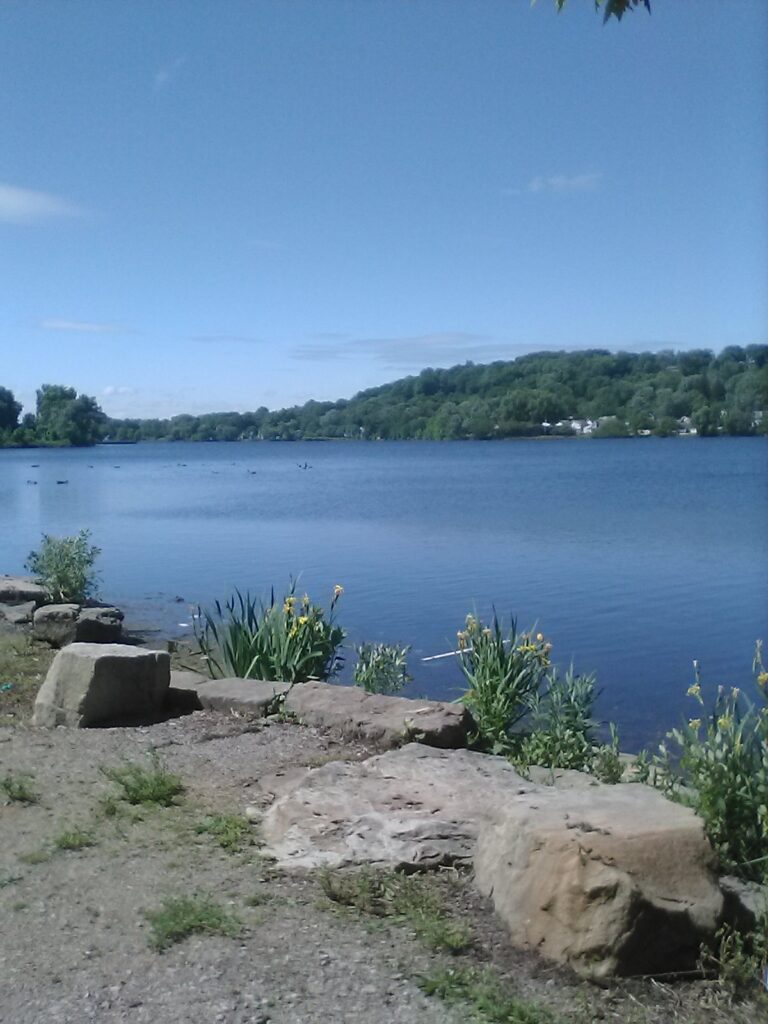
Summit Lake generally represents the headwaters of the Tuscarawas River (pronounced “tusk-a-roar-us”) and the canal followed this river south from Akron. The Cuyahoga branches off and heads east in Akron, veering away from the route of the canal. However, the Cuyahoga and the Tusk are less than a mile apart in Akron, so the canal builders needed only to bridge this gap, with water providentially supplied by Summit Lake.
The north-south continental divide runs through Akron. Suppose you placed two snowballs side-by-side in just the right spot in Akron, Ohio. When spring came, the northerly-placed snowball would melt and flow north into the Cuyahoga, and in turn, Lake Erie, flowing over Niagara Falls and out the St. Lawrence River into the North Atlantic. Meanwhile, the more southerly-situated snowball would melt and flow south into the Tuscarawas and down to the Ohio River to its confluence with the Mississippi and out into the Gulf of Mexico.
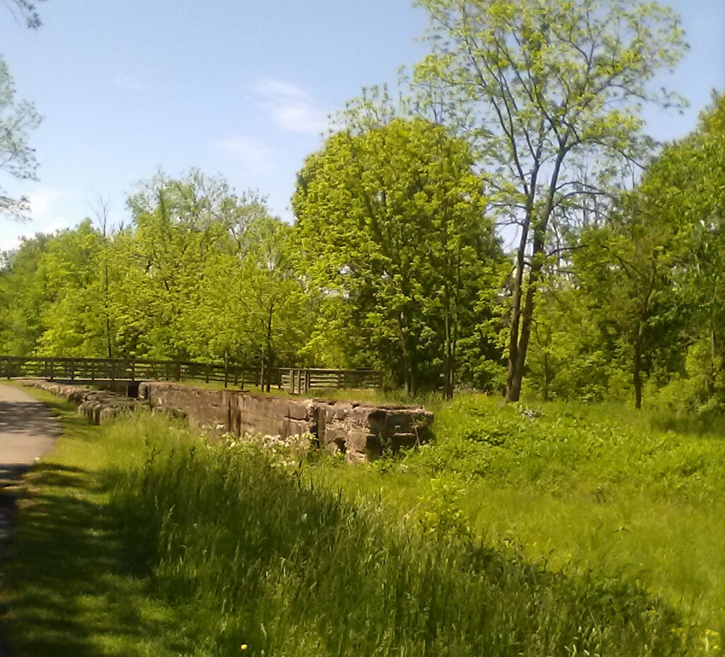
Here’s the ruins of a canal lock in Summit County. We see many of these in the Cleveland area and they can also be seen all along points south. parallel to the Tusk.
The canal still holds water in many places along the trail. It was surprising how many homes there were backed right up onto the canal and even had small boats for sailing. Very picturesque but it has to be mosquito-infested in the summer.
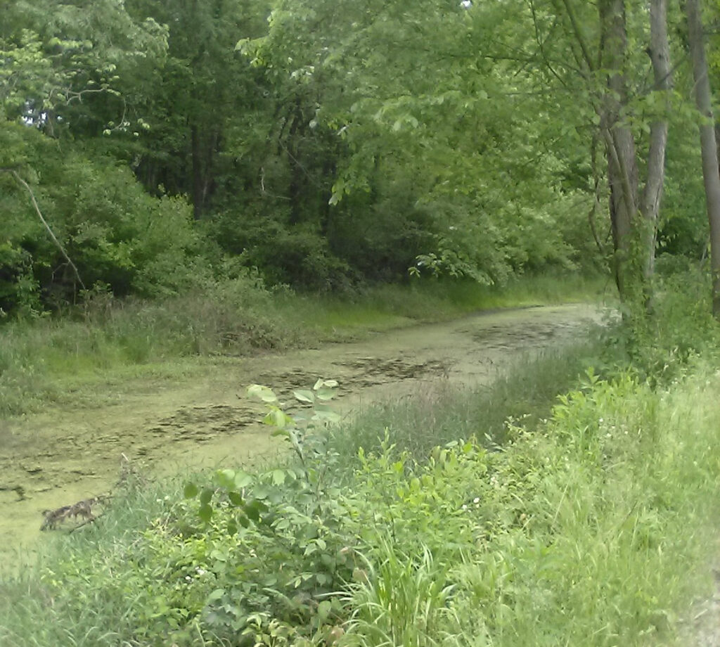
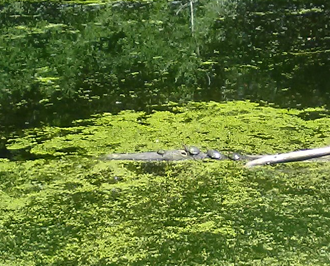
Many other stretches of the canal are swamps, covered over with green slime with paths through muck where perhaps turtles swam.
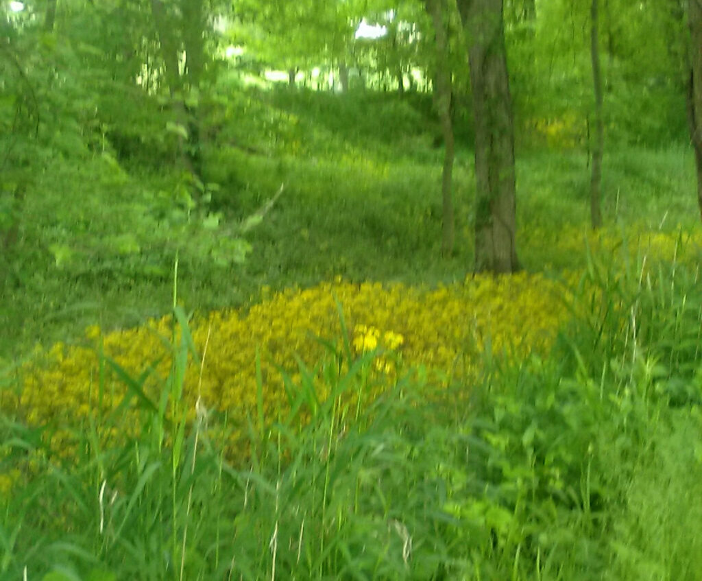
Many other lengths of the canal are dry. But being low-lying land, they apparently retain more moisture, and a widely varying array of plant life can be seen within the canal beds along many stretches of trail.
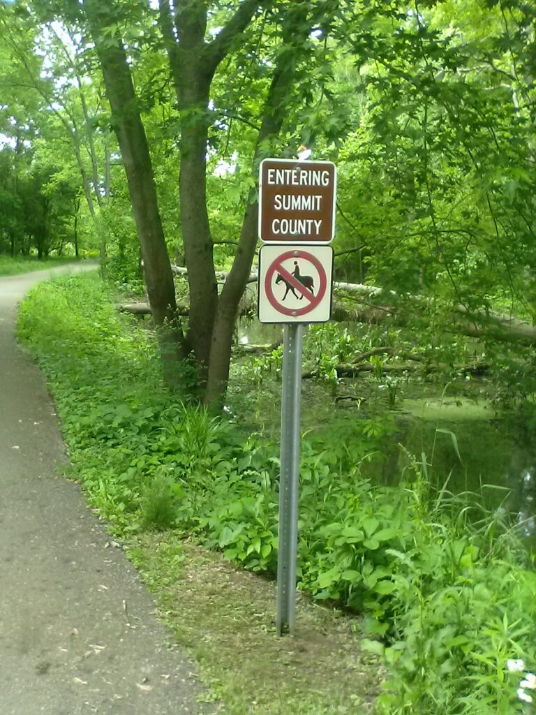
It was a fairly suburban bike ride through most of Summit County. Then I passed through the neat little town of Clinton, Ohio, at the southwestern corner of Summit County. I have not yet been able to confirm any facts, but I’m suspecting this canal town was named after New York Governor Dewitt Clinton, who used his clout and influence to develop the O&E canal and thereby extend the canal network to the benefit of his state.
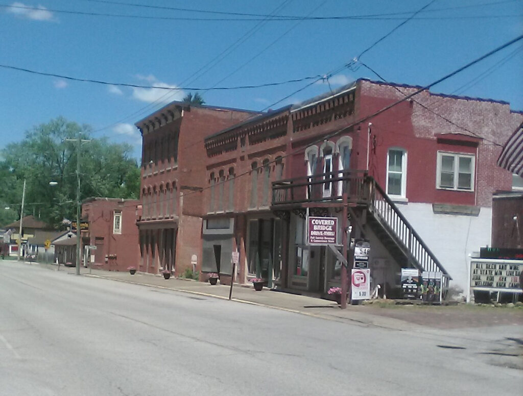
If you blink, you can miss Clinton, even if you blink while riding a bike. The main attraction in Clinton appears to be the Covered Bridge Drive Thru, a beer store made to resemble one of the many covered bridges that proliferate throughout rural Ohio. This store also advertises Copenhagen, which, as I’ve long observed, appears to be the “smokeless tobacco” of choice of many Ohio rednecks.
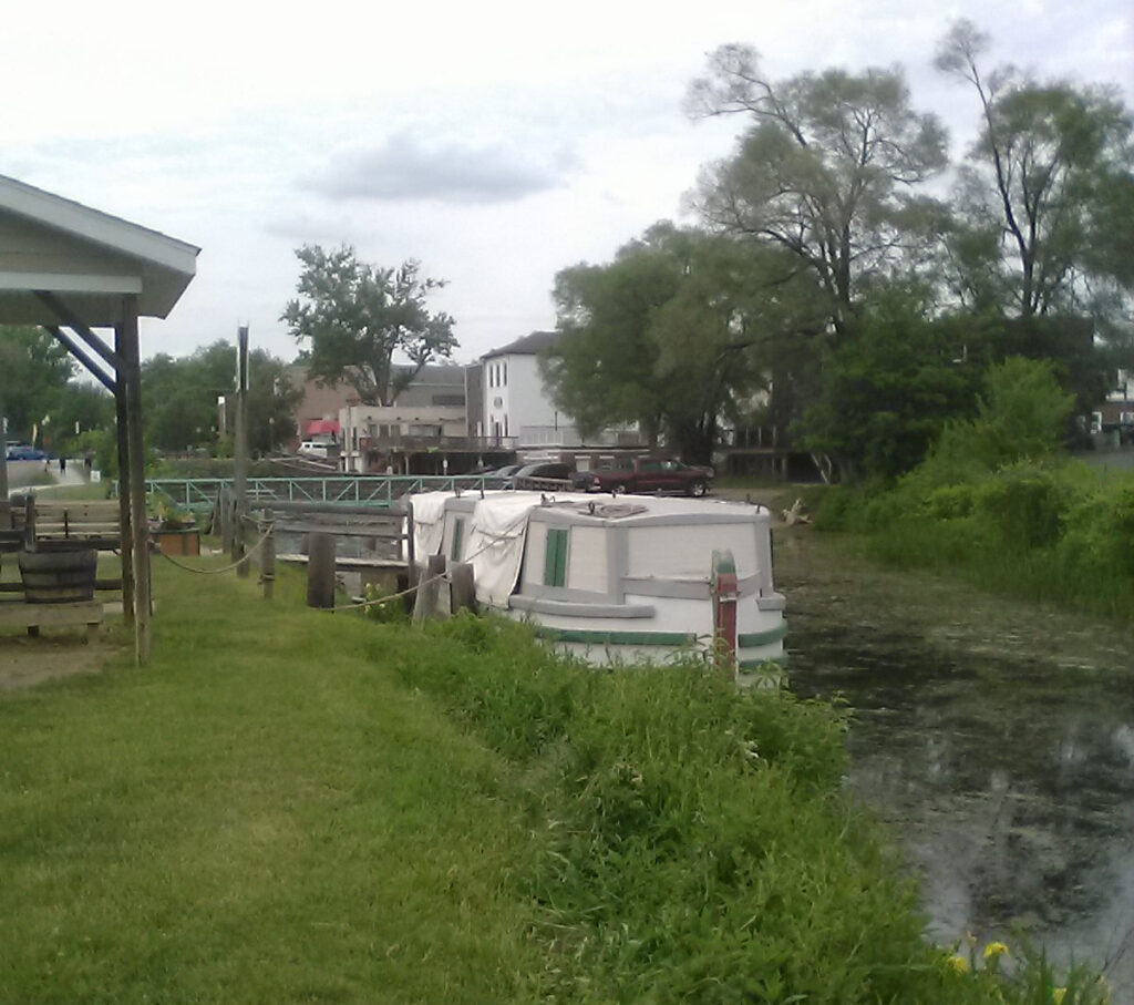
You cross into Stark County to the south of Clinton, and soon you come across Canal Fulton, the birthplace of the modern canal revival in Ohio. For a mere nine bucks, you can take a two-hour ride on a replica horse-drawn canal boat, and experience a taste of what life was like 200 years ago in the early settlement of Ohio.
There’s a big sign that tells the story of long-time Congressman Ralph Regula who, back in the 1960s, provided the impetus for creating this unique attraction, along with the early development of the Towpath Trail as a modern recreational and educational resource.
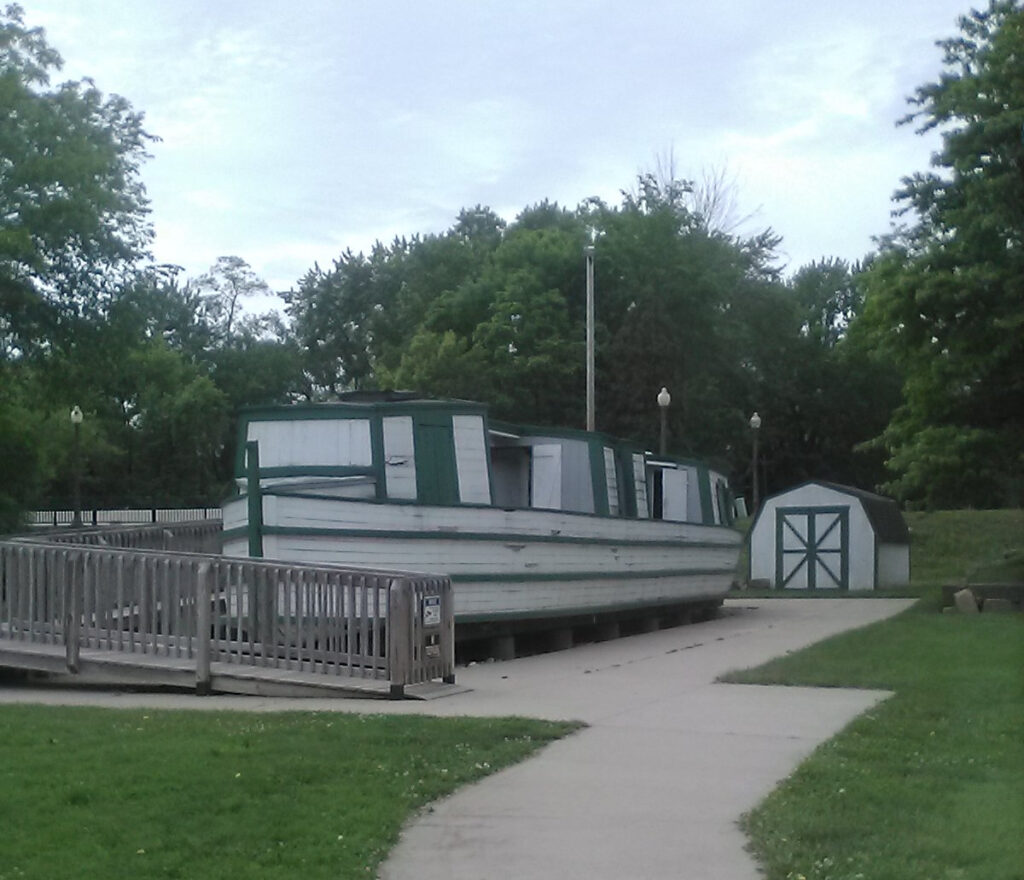
The above canal boat is the St. Helena III. The original St. Helena was an actual canal boat that worked the canal. The St. Helena II was the original modern replica from the 60s and it is on display out of the water on site.
Further south along the Towpath Trail is Massillon, Ohio, named after a French bishop from the court of Louis XIV. There is an excellent trailhead on Lake Ave on the north side of Massillon, which includes Ernie’s Bike Shop and the Blue Heron Cafe. This is wonderful and relaxing oasis where you can get food and refreshments and bike maintenance if needed. I had a roast beef sub at the cafe on the return trip and it was excellent and a great value. There is also a kayak livery on site if you wish to park the bike for a while and paddle down the Tuscarawas.
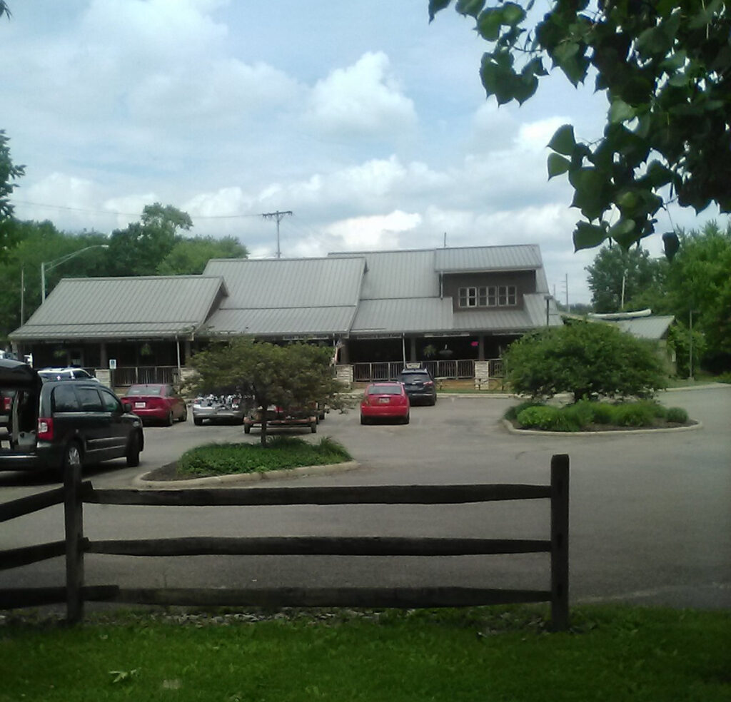
This is an interesting stretch of the Tusk along the Towpath alongside Massillon, just south of Ernie’s. There’s a Hampton Inn in Downtown Massillon in case you need a room for the night. There are also all the standard American chain restaurants you could ask for. I had lunch in Massillon on the outbound trip at 2:00 PM, only 3-1/2 hours after leaving Akron. I made surprisingly good time on this ride, maintaining about 7 or 8 mph.
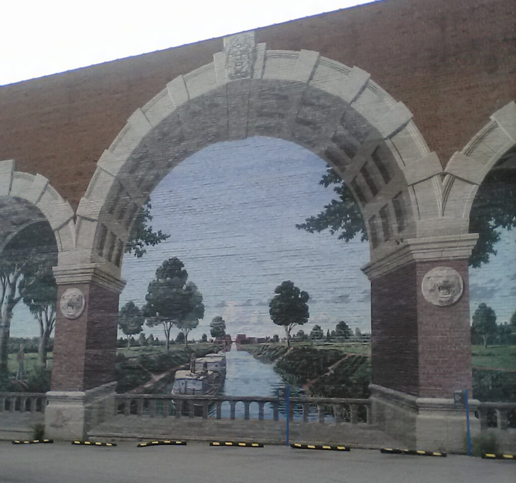
Massillon is the birthplace of silent movie star Lillian Gish, and a prominent street is named for her. There are some excellent murals along the sides of buildings in Massillon, such as this one celebrating Ohio canal heritage. There is another fine mural commemorating Massillon’s role in the creation of professional football and its longstanding rivalry with nearby Canton, Ohio (locally pronounced as “Can’t Know How”). Canton is best known as the home of the Pro Football Hall of Fame, a distinction likely disputed by Massillonians.
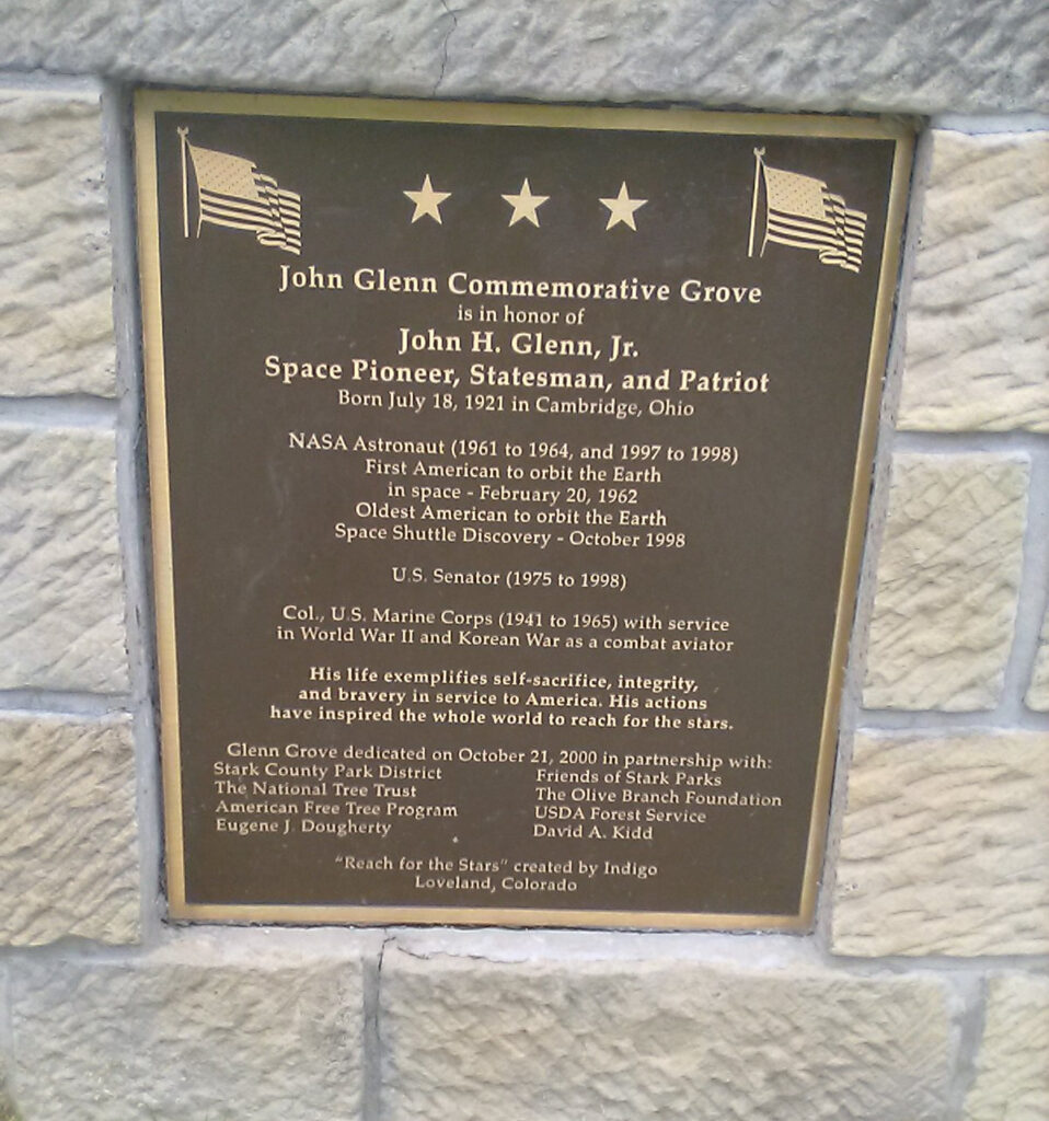
Just south of Massillon is the John Glenn Grove Trailhead with this cool statue of Ohio’s member of the original Mercury 7. Seems like half the State of Ohio is named after John Glenn. I have not voted for many Democrats in my life, but I always voted for the moderate and reasonable Senator Glenn. It’s not every day you can vote for an actual American hero.
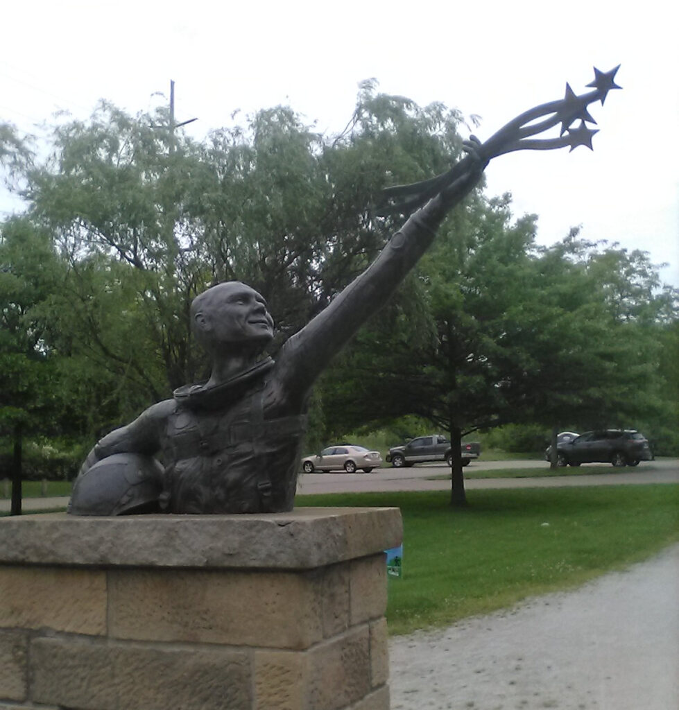
(I think he looks like Sheldon Cooper in this statue.)
I was surprised to notice from this plaque that the late astronaut and senator will have had a 100th birthday next month. Wow, time is surely flying by.
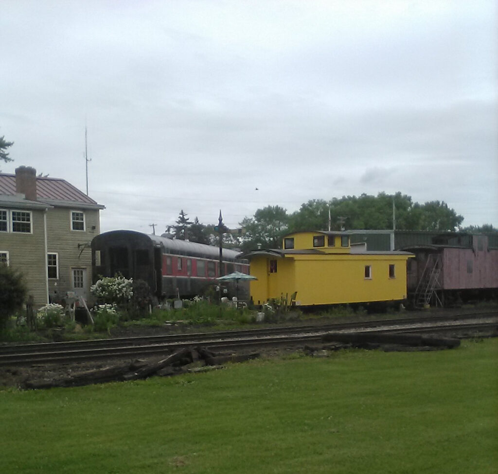
South of Massillon is the little village of Navarre, Ohio. Not much to see here, but it’s another benchmark on the map.
This is the most interesting feature along the Towpath in Navarre. Someone is obviously a train buff. I’d love to know the story!
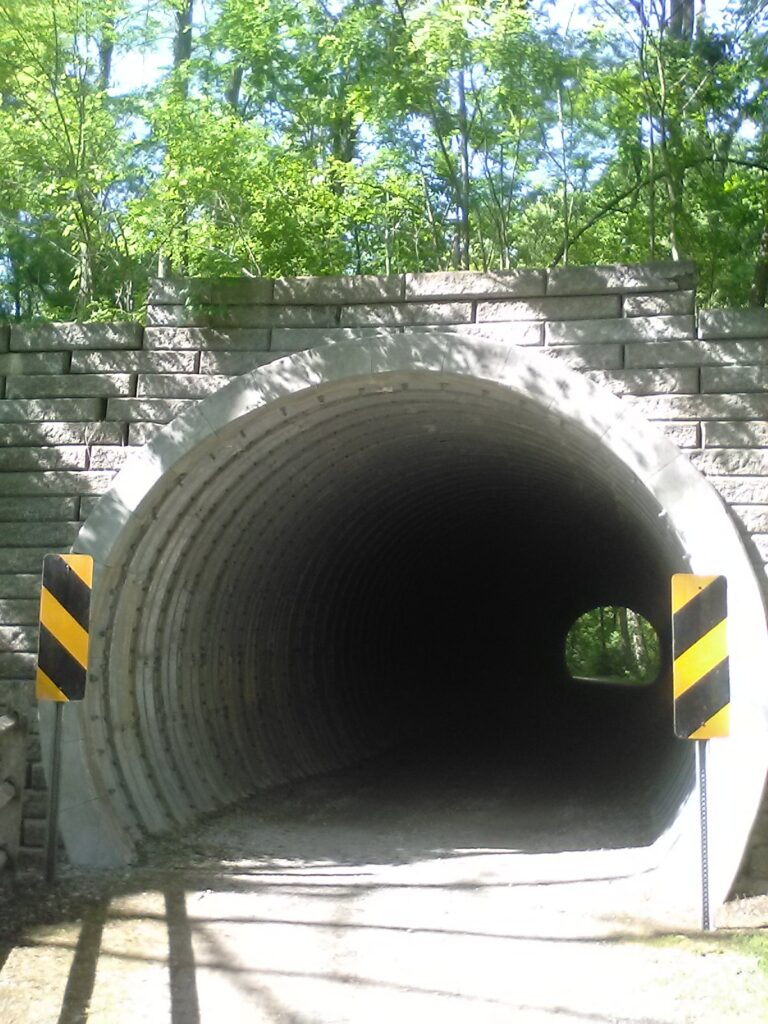
South of Navarre there is lots of woods and it’s a very shady ride. Then you encounter this tunnel which runs under a rail line. It’s very dark inside.
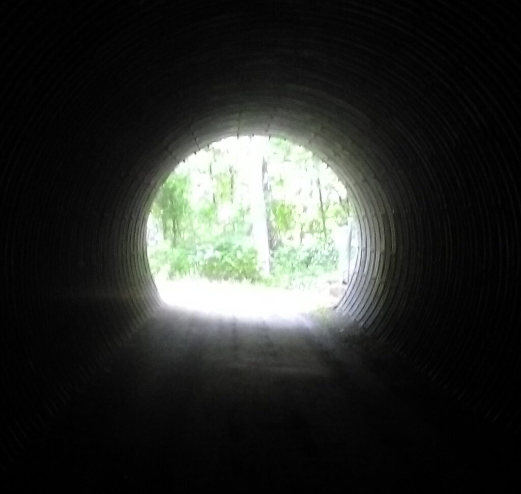
When I stopped to snap this pic and get a drink, I was deafened by the silence. No human sounds were audible. Being a total city slicker, I’m accustomed to a continuous barrage of freeway noise, trains, sirens, lawn mowers, and all manner of human background noise. You could really learn to relax and lower your stress just by reducing the constant ambient noise in your head.
After riding through woods for the longest time, you pass some interesting canal locks and a partial foundation of an old mill. Then you climb this steep hill and this lovely farm panorama opens up right on the southern edge of Stark County. I mentally named this scene “America.” Reminded me of something out of a Gary Stretar painting.
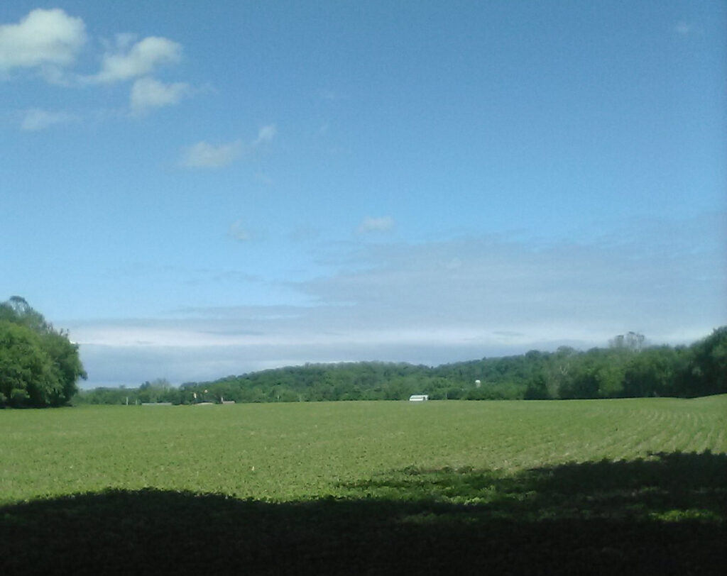
Just past that farm house, you cross a road and enter Tuscarawas County. It’s beautiful farm country and I’ll bet there are dark skies at night. I always wanted to live out somewhere like that, away from the city. The railroad in this scene is the same one with that underpass in the pix above.
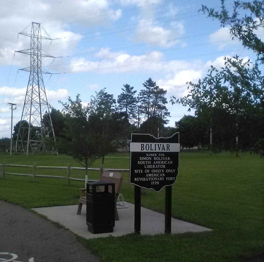
Just over the county line is the town of Bolivar, Ohio.
Though the town is named for Simon Bolivar, after whom the nation of Bolivia is also named, the locals pronounce it so it rhymes with “Oliver,” following the longstanding Ohio tradition of mangling foreign pronunciations (e.g., Medina, Lima, Toledo, Milan, etc.)
The little town of Bolivar is the cutest, quaintest little Ohio town you ever did see. And I was startled when I came across this building, which was the setting of the locally-produced film, Old Fashioned, probably the cutest, quaintest little Christian indie film you’ll ever see. This store was the setting of “boy meets girl” in that flick.
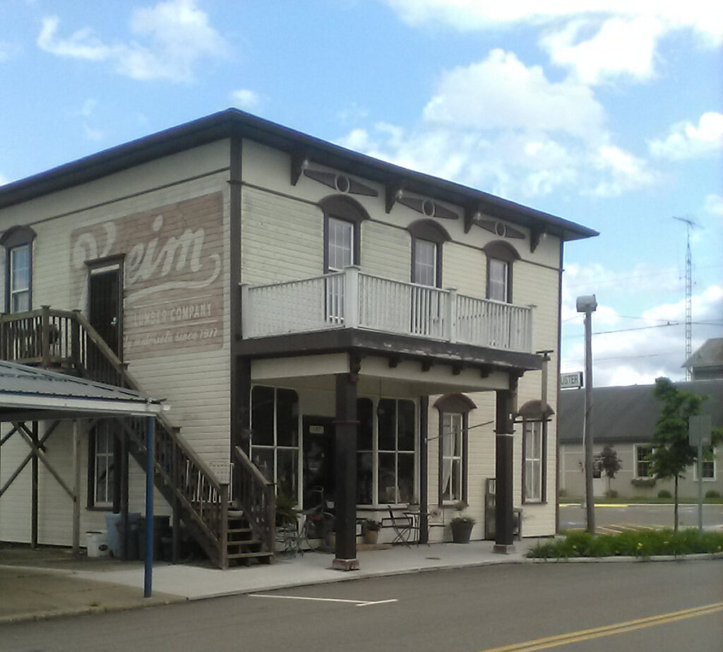
Old Fashioned also co-stars Joe Bonamico, a local actor memorable for his scene-stealing performance as the irascible frontier villain Simon Girty in the aforementioned outdoor drama, Trumpet in the Land. I really recommend Old Fashioned, it’s a very sweet yet blunt movie about chivalry, traditional romance and the merits of “saving it for marriage,” with fantastic cinematography that showcases the rural Ohio landscape.
But I saw not a single soul as I rode my bike through Bolivar. Finally, on the edge of town, I passed a guy who nodded and gave me a friendly greeting, like every other Ohioan you meet once you get away from the big cities.
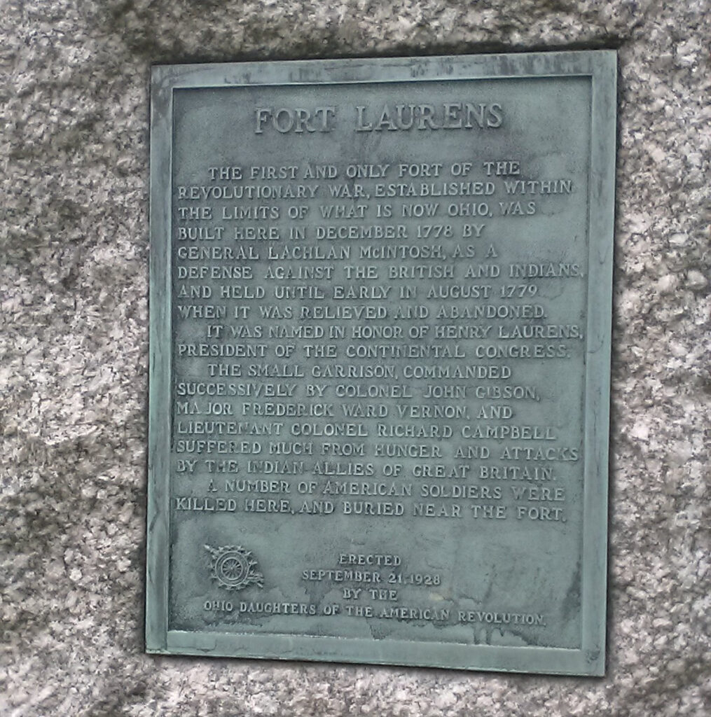
Bolivar, Ohio is the site of Fort Laurens, the only Revolutionary era fort on the Ohio frontier. There’s not much there but a field and some commemorative stones and a museum that does not appear to be open very often. But it’s interesting to pick up a few more nuggets of Ohio history.
I had intended to stop for the night at the Sleep Inn off I-77 in Bolivar. But it was 5:30 PM, only seven hours after leaving Akron, and I was within 10 miles “as the crow flies” from New Philly with three hours of daylight remaining. My legs still felt great and I still had a lot of energy so I decided to go for it. But there was more entailed than a simple crow flight. I made it to New Philly before sunset, but it was the most wild, desolate, remote section of the trail and had the most difficulty of any other section thus far.
There were several interesting locks in a row south of Bolivar. This is the best pic but they were all unique and interesting in their own right.
WILDLIFE
One of the best parts of this ride was all the wildlife encountered along the full length of the Towpath Trail. I saw these turtles in Summit County, possibly still within Akron. I saw other turtles throughout the day, maybe a dozen on a single log, but they all dunked into the water when they saw me. The pic does NOT do justice to the actual scene.
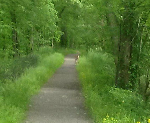
I saw all kinds of deer throughout the day. This doe ran away after I tried to get closer. I saw numerous blue herons, though they did not sit still to be snapped. Chipmunks were constantly scrambling in front of me, including some that did the hilarious “Chip and Dale” thing of chasing each other’s tails. Red wing blackbirds, which I considered special in my youth, were as common as sparrows. The spectacular comeback of wildlife is a testament to how Ohio and its cities have been diligent about cleaning up industrial pollution after the devastation that my generation knew as kids.
The best scenes were the ones I could not snap. At one point in the deep wilds of Tusk County, I saw some large animal that was the size of a dog, a Lab or a Golden Retriever. As it ran off into the bushes, I was stunned to see that it was actually a raccoon! It was YUGE! Not long afterwards, I passed three cute little raccoon kits, so tiny they could each fit in the palm of my hand. They did not have the sense to run off but just moved to the side of the trail. This one little guy stood his ground and barked at me. I said to him as I passed, “Oh, you’re a little tough guy, aren’t you?” I didn’t care to stop and possibly have to deal with their mom.
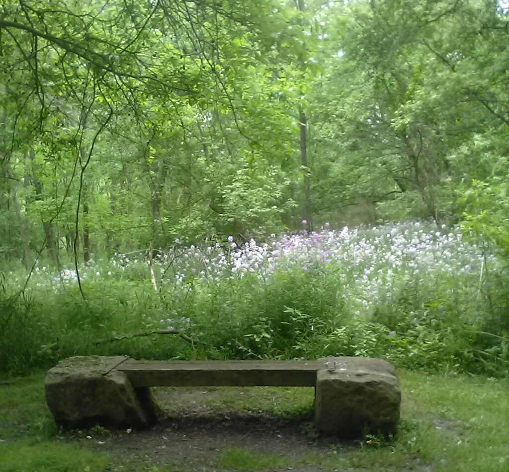
The entire length of the ride I saw these purple and white wildflowers that my wife tells me is phlox. There were large patches of them along every mile of the trail. I also saw patches of yellow flowers, goldenrod and buttercups, and other larger yellow flowers I could not identify. It was a constant barrage of color and wonderful smells and all manner of natural beauty, every direction I turned my head, as the landscape whizzed past.
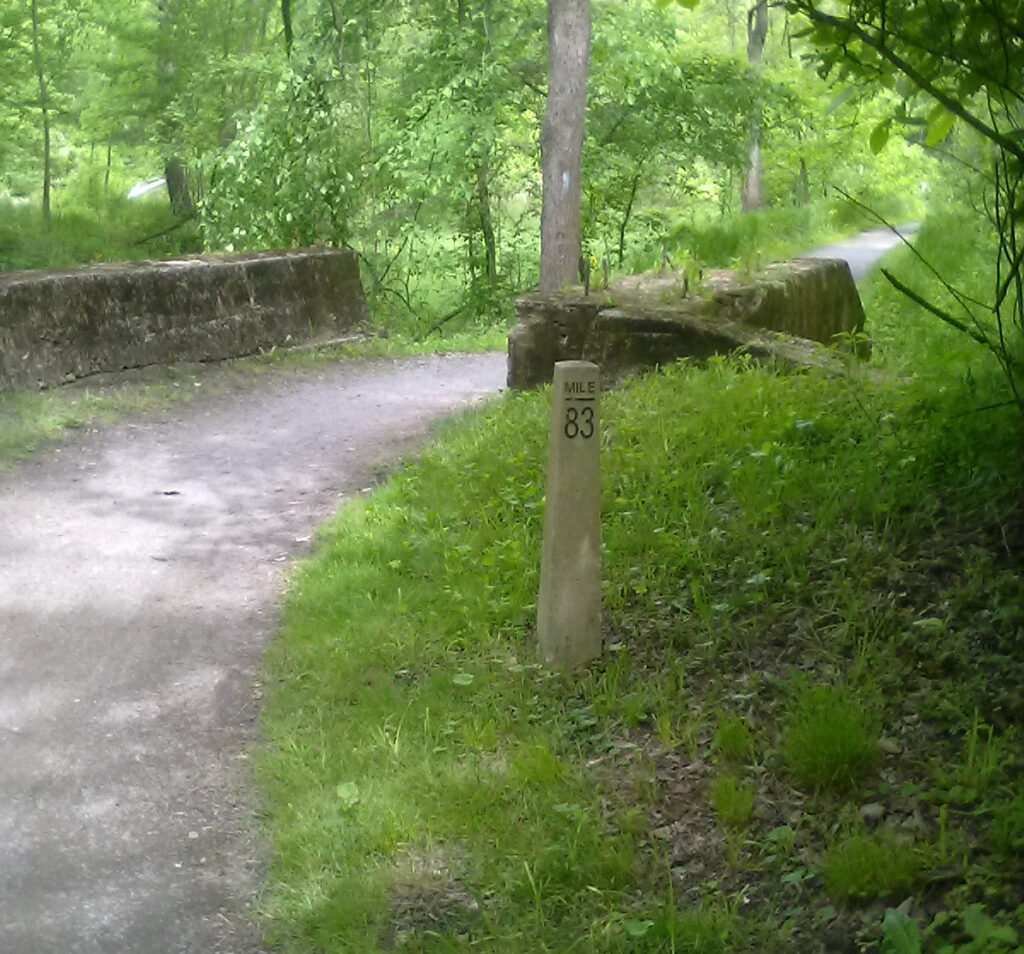
Into Tusk County I started seeing milestones again. We have this same style in Cuyahoga, where the mileage is in single digits and teens near the northern terminus. In Summit, I was seeing the same style stones with numbers in the 40s and 50s. Stark has its own style of wooden markers with their own numbering system, from 1 to about 24. It’s pretty incredible for me to see numbers in the 80s and consider how far I came on just my trusty old bicycle that I’ve owned since 1993. The last milestone I saw read 86 at the very end of the Towpath.
The Towpath Trail ends anti-climactically, dead-ending into Rt 800 in the middle of nowhere. There is evidence that the town of Zoar, Ohio is somewhere in the vicinity, but the trail does not pass directly through the town as it does with many others. So you’re abruptly dumped out onto this fast-moving country road. There are signs directing you to cross the street and clear markings on the pavement but it was not entirely clear what is supposed to happen next. I was using my buddy Mike’s 2009 edition of the Towpath Companion which was a godsend. I never would have made it that far without it. But there had been some changes in the last 12 years not indicated in this map book and I was unsure how to proceed.
I was looking for something called the Zoar Valley Trail but no such thing was marked anywhere. There was a very primitive hiking trail nearby and I did not think that was the same thing and didn’t want to take a chance riding down that. So I decided to just venture down OH 800 which runs straight into Dover, the “twin city” of New Philly. Bad move. I made several bad moves without the benefit of a clear guide, but by the grace of God, I’m still here to tell the tale.
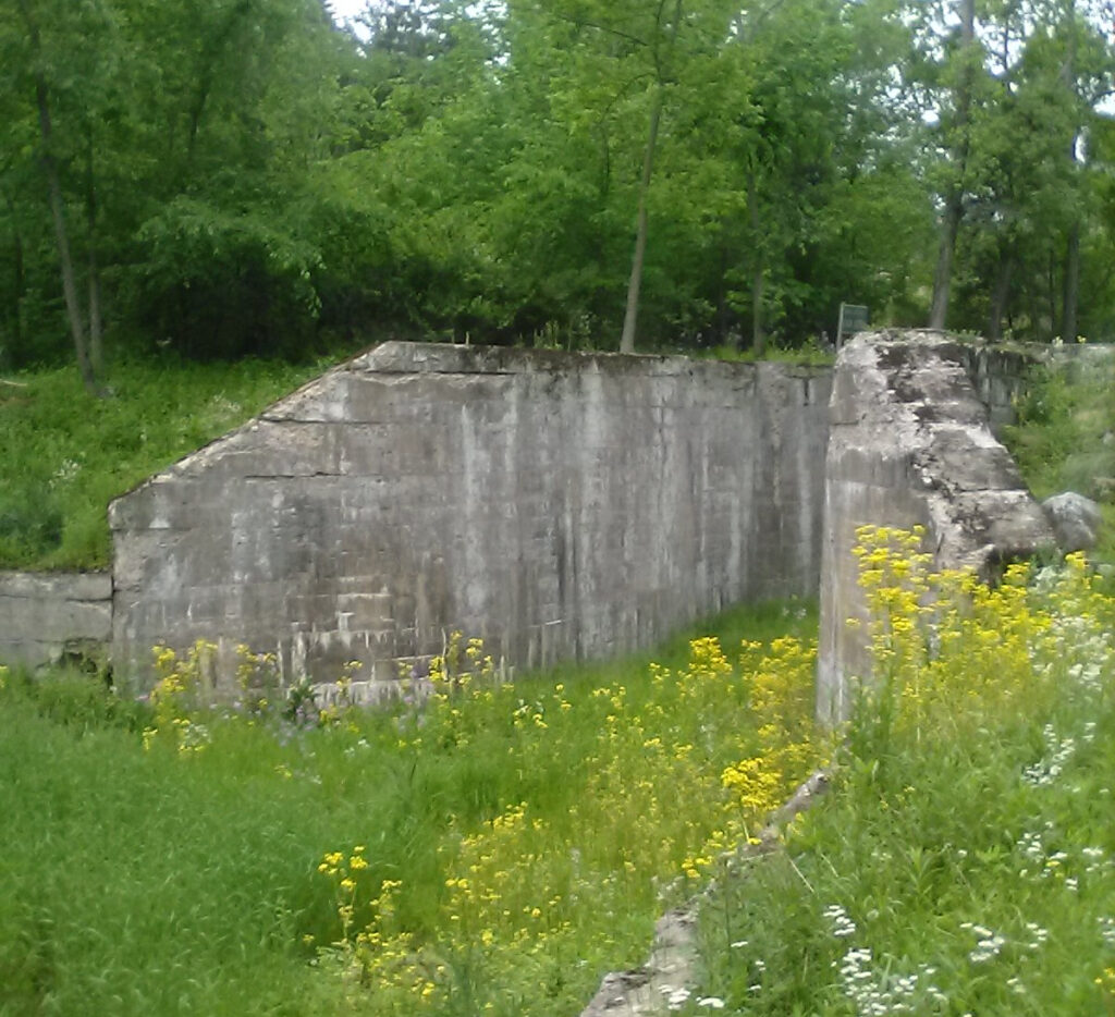
It was very unpleasant riding on that road. All manner of trucks blew by at 50+ mph. I had a tiny narrow shoulder next to the white line, and no white line in places. There was a deep ditch next to the narrow shoulder, full of all manner of odiferous roadkill, including deer carcasses that had apparently been rotting for years. I envisioned being pushed by a truck head down into that ditch to join the roadkill. The stench of death was constant. At least it was a gentle downhill coast, and thankfully, the pace of traffic was slowed by road construction. The bright side was, I got to see Dover Dam, a very interesting piece of modern engineering along the mighty Tusk.
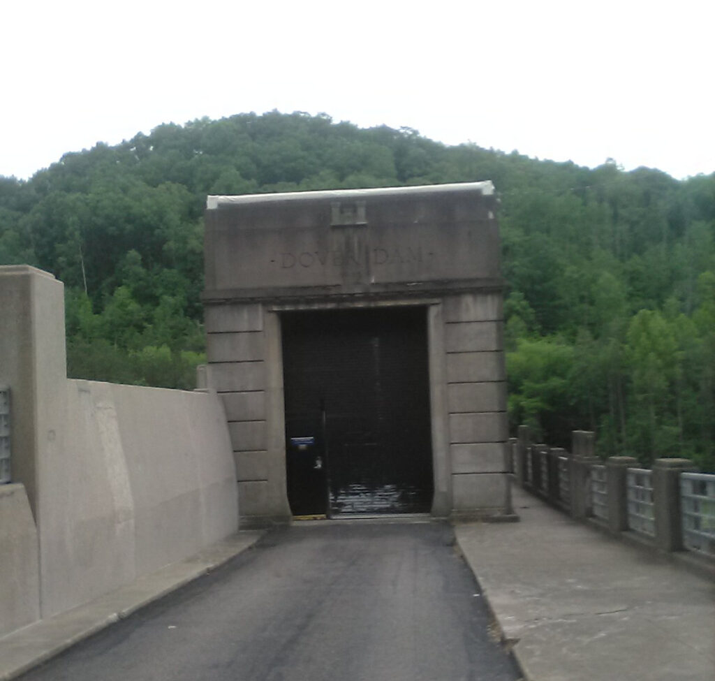
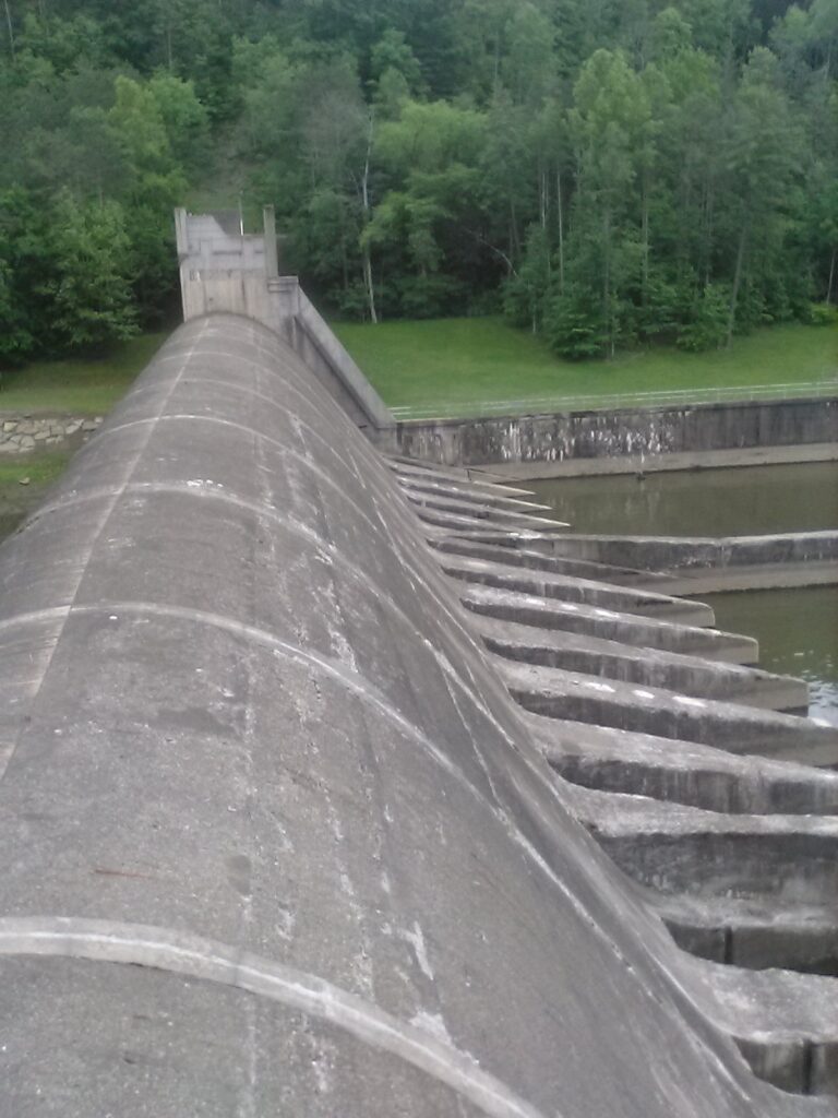
Later I consulted the Google map printouts in my pack and discovered that that funky, poorly marked trail actually was the Zoar Valley Trail. There is really bad signage in that area. I took that trail on the return trip and there were no signs or markings at all at the other end. This is probably fine for the locals who know the deal but not for city boys 70+ miles from home. I got to see the Dover Dam from the other side, blowing off a barricade with a stern “NO TRESPASSING” sign posted by the Army Corps of Engineers, the only clear signage on the trail. But I was already a half-hour up the trail with no available alternative routes and that trail was the only road ahead.
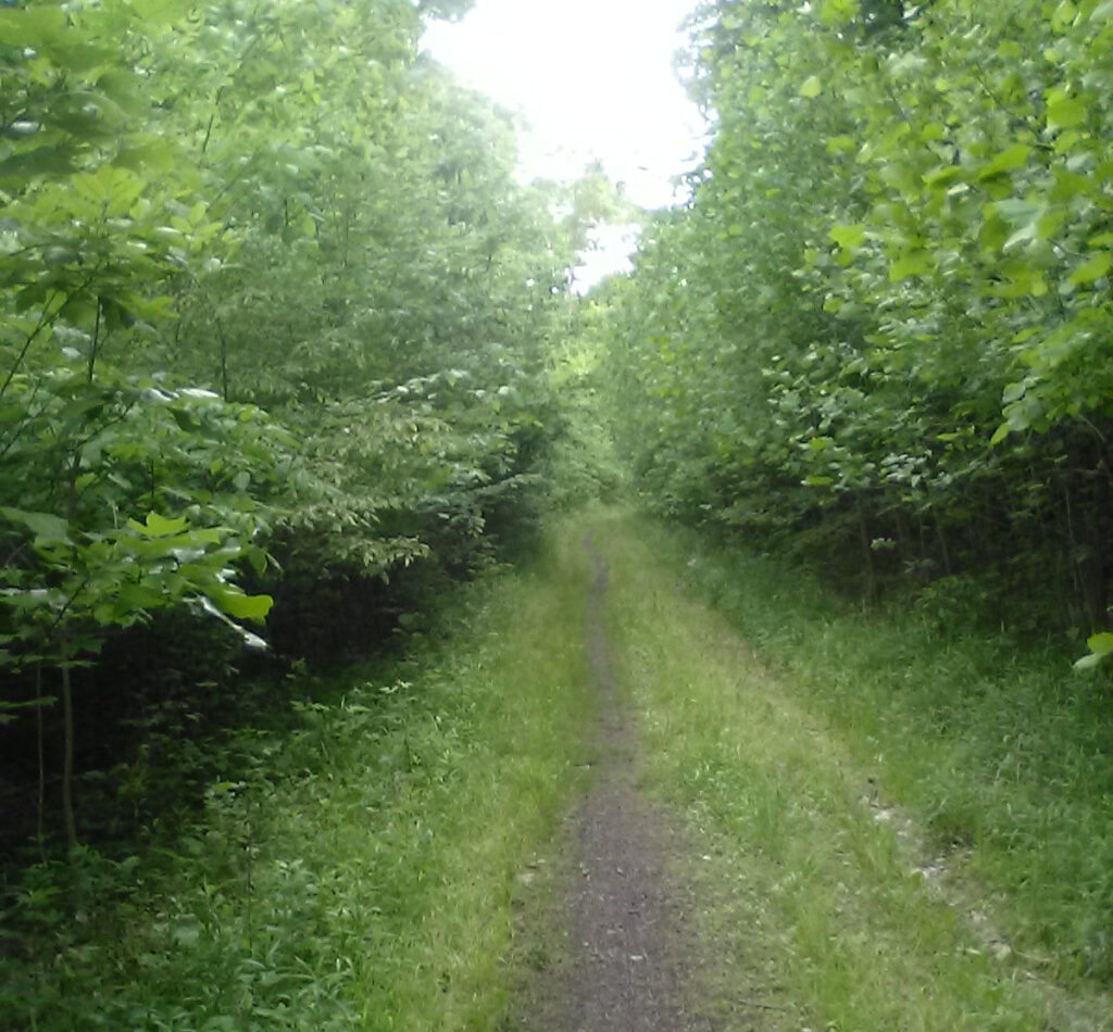
This pic below shows what the Zoar Valley Trail looks like. It starts out fine enough as a gravel trail at the bottom and becomes rougher and rougher along the way to the top. Thankfully, it has a very gentle grade, being an old railway line. In places the remains of railroad ties can be seen on the trail. It was an easy ride up the hill, hardly noticeable. But in places it’s just a narrow path through the woods and I kept getting spider webs spread across my face. I took off my glasses and had a couple little spiders dangling from them. In places the trail is nothing more than rutted mud. Someone laid a couple boards over the mud and I managed to keep the tires moving straight over the boards. But all this was fun and added to the sense of adventure.
But something was still screwy when I got to the top and ended up in some neighborhood, not the spot where I had been previously. So I took a chance and followed the road and it all worked out.
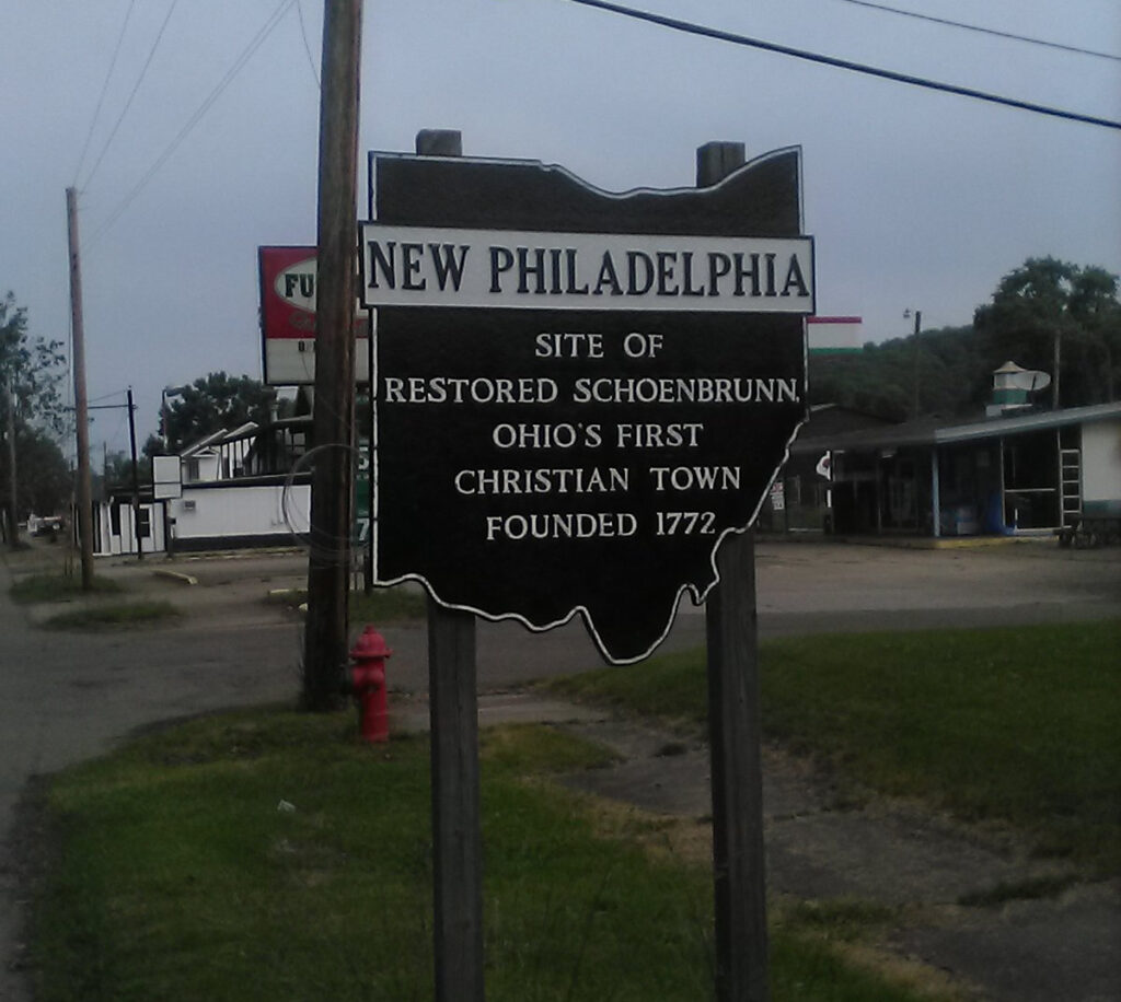
So anyway, back to the outbound trip. It was about 7:30 PM as I was getting into New Philadelphia, 9 hours into the ride. I was still feeling really good, very surprised since this was my longest bike ride ever. Here’s the sign on the south side, which I saw on the return trip.
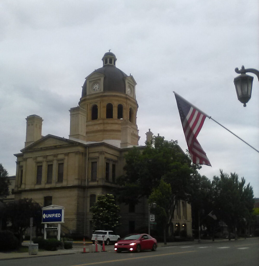
The most prominent building on the New Philly skyline is the Tuscarawas County Courthouse, a very fine sandstone building. New Philly and its close neighbor Dover are like Mayberry USA. You expect to see Sheriff Andy and Barney Fife and Floyd the barber and other such like friendly town folk.
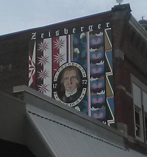
I was happy to see this mural on the side of a nearby building. commemorating David Zeisberger, “Schoenbrunn Peacemaker.” If only his legacy of peace and friendship with the native tribes had prevailed instead of frontier bloodshed, we’d be living in a different America today.
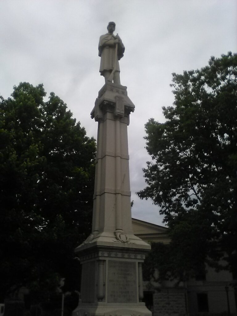
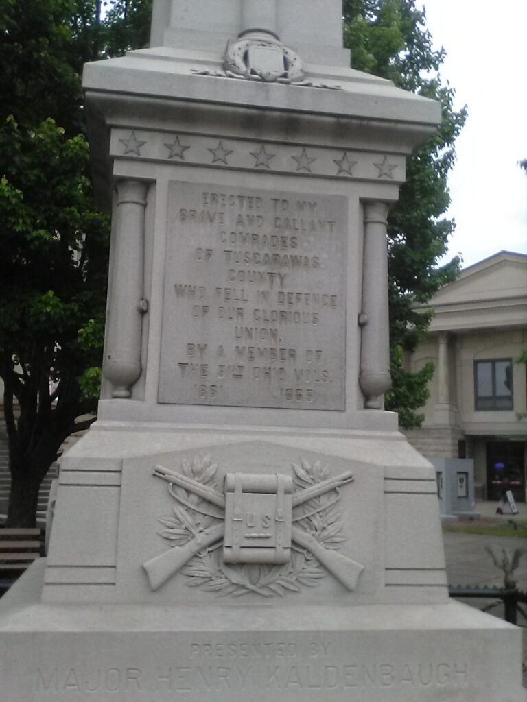
Here’s the Civil War monument in front of the Courthouse. Having visited the south and seen monuments which I find distressing, it always warms my heart to see our northern monuments that commemorate the Union and the sacrifices made to preserve it.
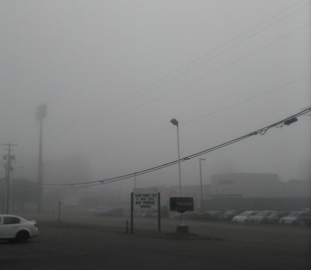
I checked into the Travelodge and slept nine hours after that punishing bike ride. I did not realize it upon check in but the motel was right along the bank of the Tuscarawas. It got down to 41 degrees that night. After the 90 degree heat wave of the previous week, it set off some early morning fog the next day as warm vapors rose from the river and condensed on colliding with the cold ambient air.
My wife’s sister Susie and her family live in neaby Dover, the “twin city” of New Philly. I did not make any firm plans with them since I honestly did not expect to make it that far. But I texted Susie and my niece Jessica and happily found myself invited to a Memorial Day gathering celebrating the birthdays of my other niece Sarah and Jessica’s son Dylan. So I took it easy on Monday and enjoyed a pleasant and relaxing visit with family. Wouldn’t you know it, after coming all that way, I got a flat tire! I was very grateful to God that it happened close to my destination. If I had to pop a flat anywhere, it could not have been at a better place. So the LORD was looking out for me! My brother-in-law Mike helped me fix it and I was good to go for the remainder of the trip. And, like they said in Apollo 13 after the minor engine malfunction at launch, “that was my one glitch for the mission.”
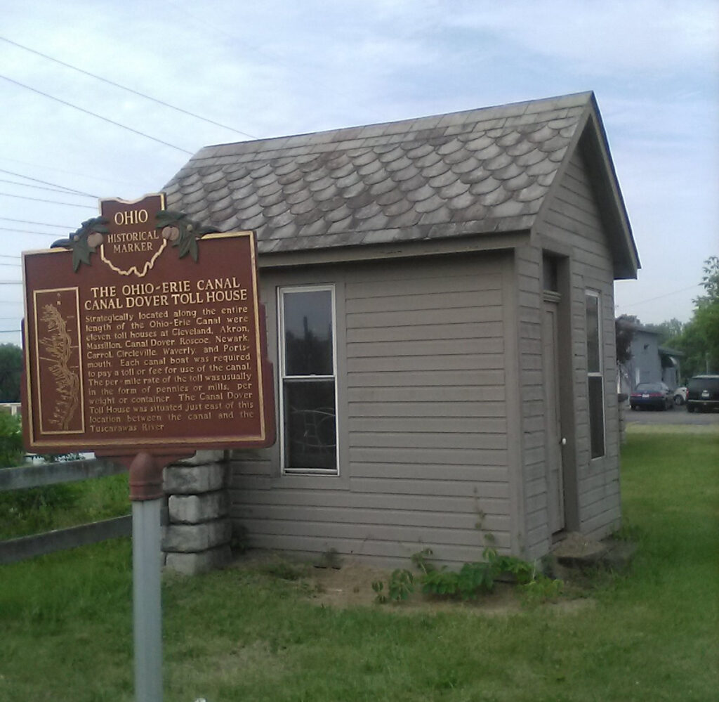
It was a lot of fun riding my bike around Dover and New Philly. These towns are virtually identical and indistinguishable, with no clear boundaries between them. They’re like adjoining suburbs in Cleveland, like how there’s no difference between Parma and Parma Hts. They both have a south side to the south of the river and both have a Front Street along their riverfronts, due to a riverbend that encircles the south side of Dover and the contiguous north side of New Philly. They are collectively a neat little place with lots of interesting spots tucked away here and there. Lots of old 19th century sandstone walls like I love at home in Cleveland and elsewhere along the canal. There are so many alleys, which are cool to ride down and safer with less car traffic. After coming to Dover for 35 years with my wife Debbie and her family, I learned more about this place in one weekend riding my bike.
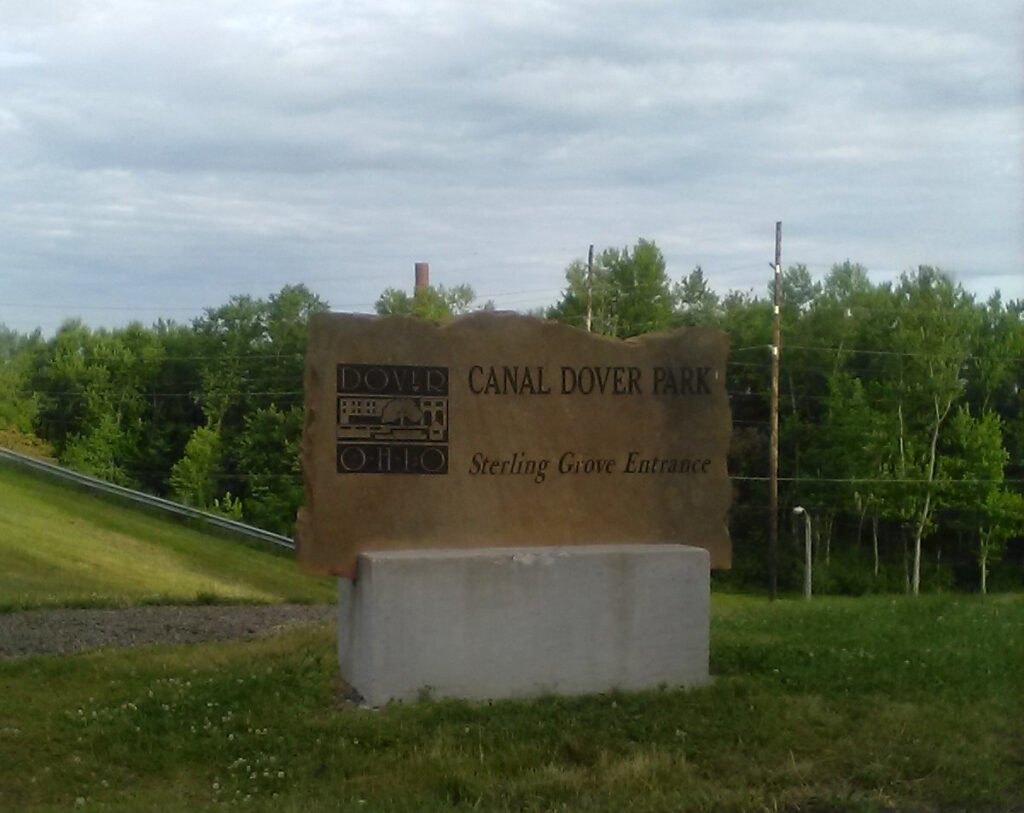
I was pleased to learn that Dover and New Philly are spending $$$ and acquiring property to reclaim their canal heritage. And someday, if I live long enough, their trail will properly join up to the rest of the O&E Towpath Trail.
After crashing early on Memorial Day, I woke up at 4:30 AM on Tuesday and could not sleep any more. I was not sure if I wanted to complete the bicycle pilgrimage, being sort of spooked after the flat tire and all. I considered heading directly home and coming back another time with my car. And I considered going to the Enterprise car rental place in New Philly rather than tackle the return trip on my bike.
But I was awake and ambitious so I made a snap decision to carry on. So I made an early start and left at 7:00 AM for Goshen Cemetery, a few miles south of New Philly. If you ever attempt the same thing, do NOT ride south on Broadway on OH 416 out of New Philly. Lots of traffic, kind of tricky and risky on a bike, and the rural road is curvy with a narrow shoulder. Instead, come down on High Street on OH 259. It’s a straight road, very wide, with a nice wide shoulder for safe and pleasant riding.
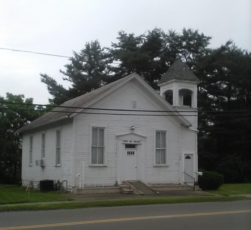
I saw this ancient little church along OH 416 in South Philly. It looked forlorn and abandoned but I’m sure it has an interesting history.
AT THE CEMETERY
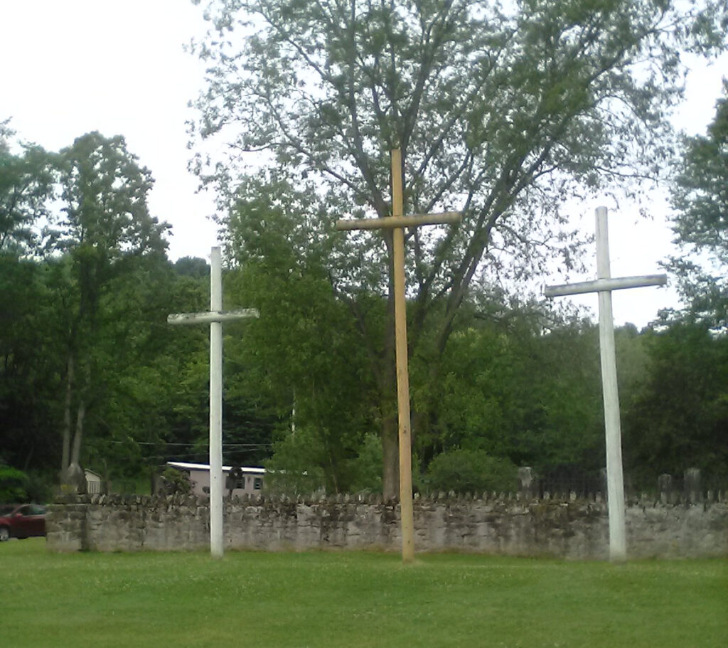
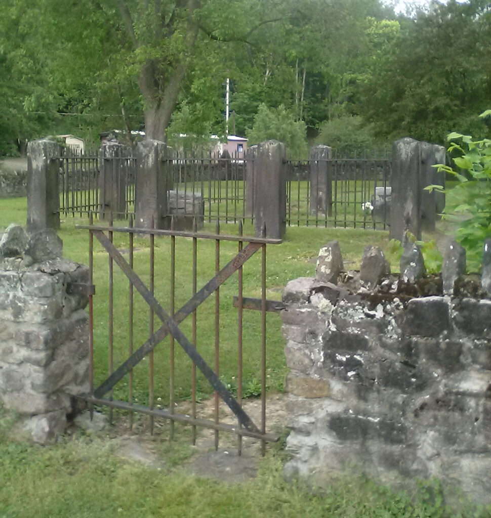
I made it to Goshen Cemetery before 8:00 AM. It’s a tucked away little community with some small businesses and a little Nazarene church. The cemetery is hard to miss….
The sign tells you everything you need to know….
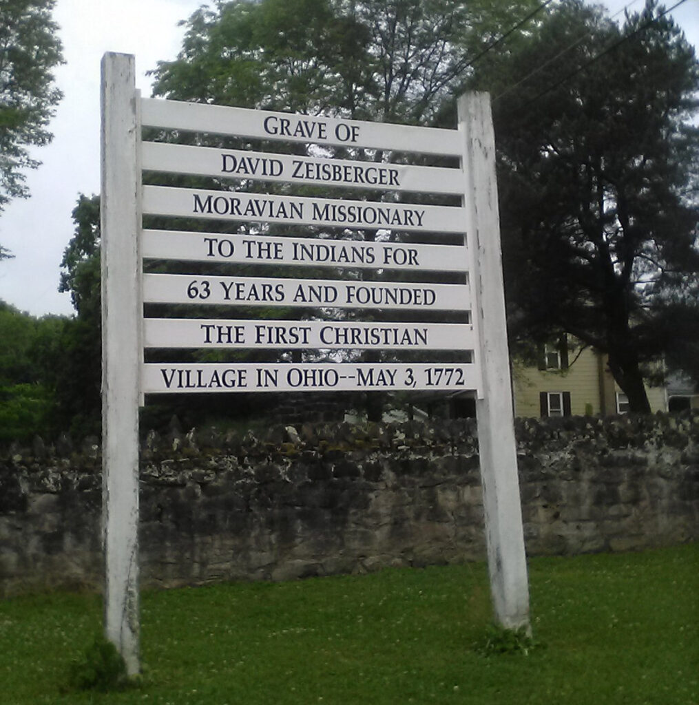
The 200 year old graveyard might well be the oldest in the State of Ohio.
I said a prayer as I approached the grave of David Zeisberger. I thanked God for the love and decades of service of this man to the native people of Ohio. And I was frustrated that so much tragedy befell these kindly and peaceable folk who lived together in a community with no distinctions of race.
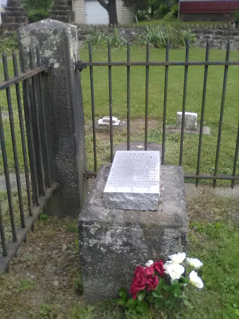
Cemeteries of the ancient dead always fascinate me. Just as I felt at the grave of Benjamin Franklin in that “other” Philly, it’s so intriguing that the very bones of the great man lay just a few feet below me.
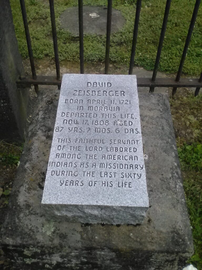
I also marvelled that a man could live to such an advanced age in a frontier land with malaria and violent winters and likely little or no medical care. But just as I pondered before setting out on this grueling bike ride, “that which does not kill you makes you stronger.” I can only imagine that to be especially true of frontier life.
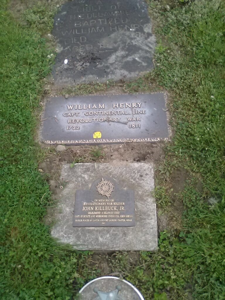
There are many other graves in this cemetery, including those of many of the “praying Indians.” Just their first names were etched in the stones, no last names and no years of birth and death. I’d bet many did not know the years of their births according to the western calendar. I was especially touched to see Joachim, who was mentioned by Heckewelder as being Zeisberger’s interpreter to the Indians, when he would give his gospel sermons and many Indians would accept Christ. Such a picture Heckewelder paints in his Narrative of the Delawares and Wyandots and the Cherokees and other tribes, as all being intelligent people not so different from the Moravians, who wanted the same basic things from life, many of whom found contented lives as Christians.
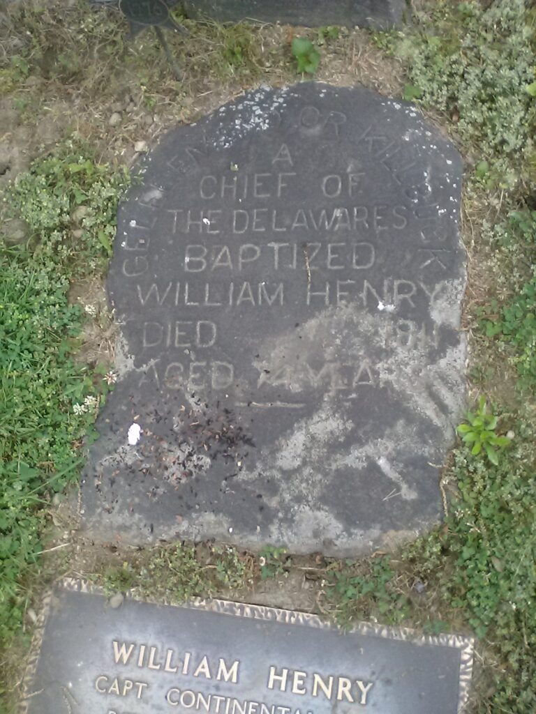
A notable praying Indian was Gelelemend, aka Killbuck, aka William Henry, who is buried alongside Zeisberger. He was mentioned several times in Heckewelder’s Narrative. His story is quite interesting and typifies the difficulties encountered by the praying Indians living on the 18th century Ohio frontier.
Toward the end of his Narrative, Heckewelder describes the rise of the Ohio native war chief Tecumseh, who called on the Ohio native peoples to reject Christianity and westernization and return to the old ways and the worship of the Great Spirit. Tecumseh and his movement arose in part due to the mistreatment of the Moravians by the American settlers and the U.S. Army. This same attitude on both sides typified the subsequent westward expansion. Though it is not generally recognized, it seems so clear to me that the ministry of David Zeisberger and Moravian mission represented a watershed moment in American history, and sadly, the wrong road was taken.
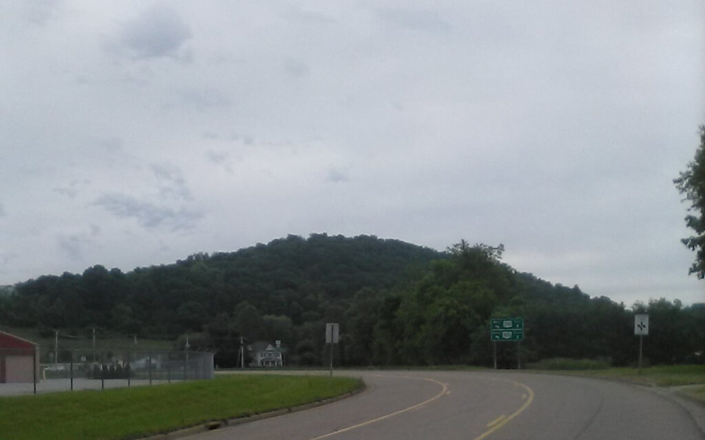
I left the site reluctantly but I had 12 hours of daylight and wanted to get started on the long ride home. Suffice to say, I was still quite tired from the outbound trip and was operating with five hours of sleep from the night before. But things went well overall. I admired the surrounding countryside. That area of Ohio is the foothills of the Appalachians. There is mostly flat land to the north of Dover/New Philly and small hills to the south, with increasingly big hills into West Virginia, Virginia, North Carolina and Georgia. I was grateful that I did not have to climb those on my bike!
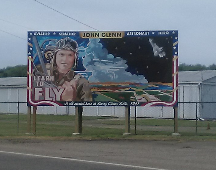
I saw this sign on OH259 back to New Philly, outside the local airport. More proof that half the State of Ohio is named after John Glenn!
It was a long, weary day but I was determined to sleep that night in my own bed. I retraced my path through Tusk County, back through Stark County, and I was very happy to see this sign! My wife Debbie picked me up in Akron at about 7:30 PM, more than 12 hours after leaving the motel, and over 70 miles of pedaling. I was gone from home about 60 hours and I spent about $200, most of which was on the motel. What a wonderful experience! I encourage you all to do the same!
Oh, my! Not only did I love your mini history lesson, but I loved your grammar skills! My kids call me the Grammar Police! 🤣
This was so lovely to read and what a walk down memory lane! I’m an Ohio girl myself, who happens to live in North Carolina, and my husband and I lived in the Akron area until 2003 when we moved to Columbus. The pictures were beautiful and made me a little homesick. 🙂
Thanks for reading that. Yeah, I’m also of the vanishing breed that believe in proper English. I updated and finished the story, you might want to read the rest.